
Lebanon's cadastral map,
in your pocket
Find any lot by its number, see the land in 3D, measure it on the map or on foot, and keep whole zones offline.
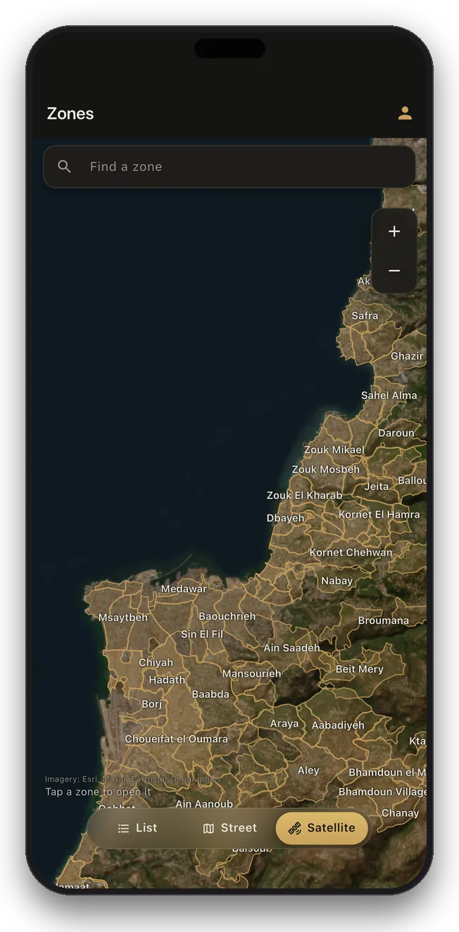
Every zone, on real maps
Switch to street or satellite and see every covered zone in place on the country map, from Akkar to Naqoura. Tap one and it opens.
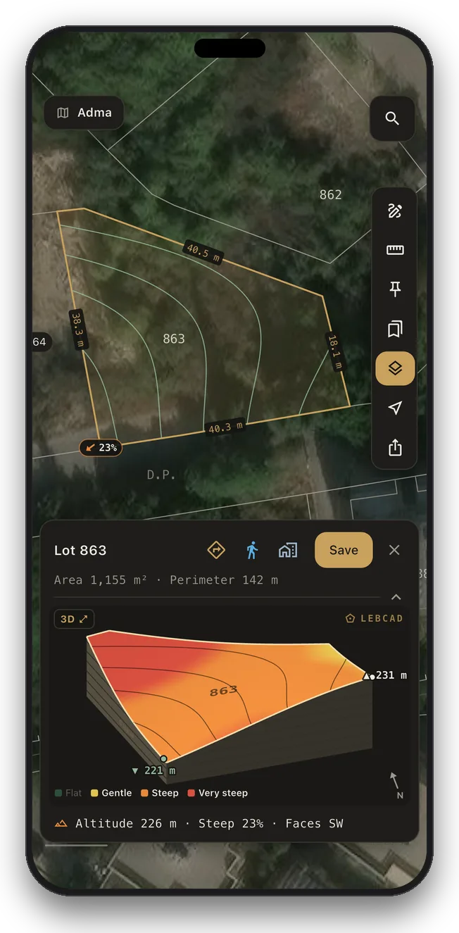
See the land in 3D
Tap any lot for its altitude, slope and facing, with a 3D model of the land you can turn and tilt. The heights are built into the app, so it works offline too.
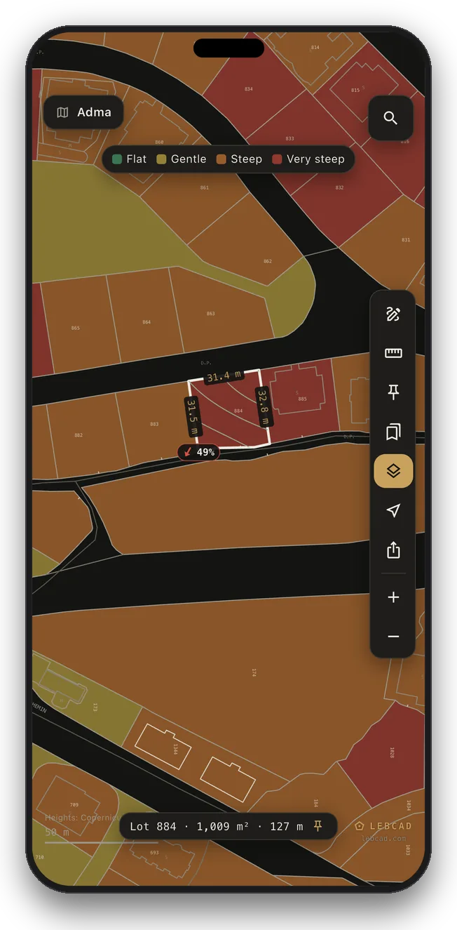
Every lot shaded by its slope
Turn on Terrain and every lot in the zone is coloured flat, gentle, steep or very steep. Or draw height lines over the map, satellite included.
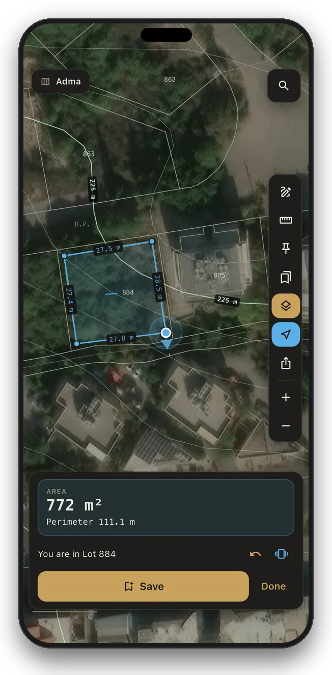
Walk your land and measure it
Tap the location button to see which lot you are standing in. Walk its edges with your phone in hand: the app guides you to each corner, buzzes as you near a border, and measures the area and side lengths of the path you walked. Accuracy follows your phone's GPS, usually a few metres.
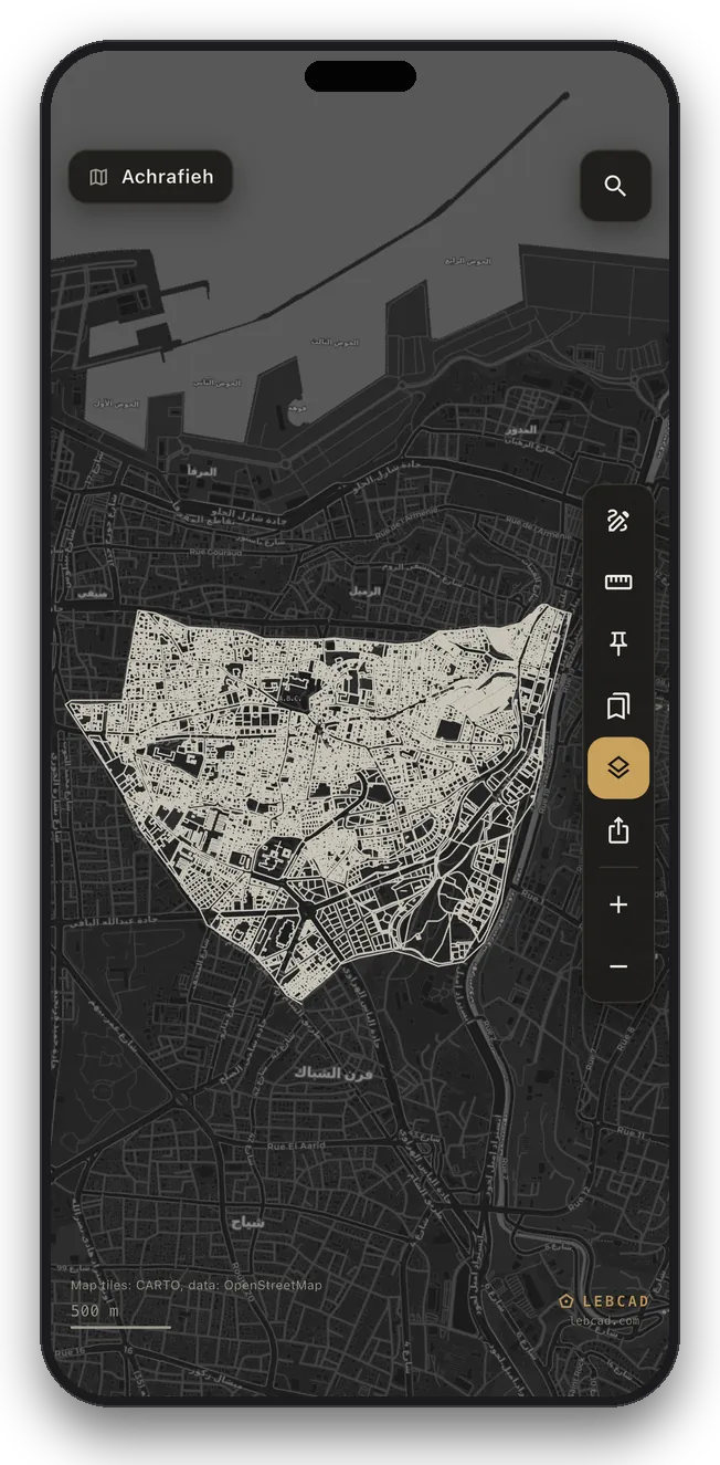
The cadastre over the real city
Every parcel drawn over rooftops and roads. Tap a lot and it lights up with its area, its perimeter, and the length of every side.
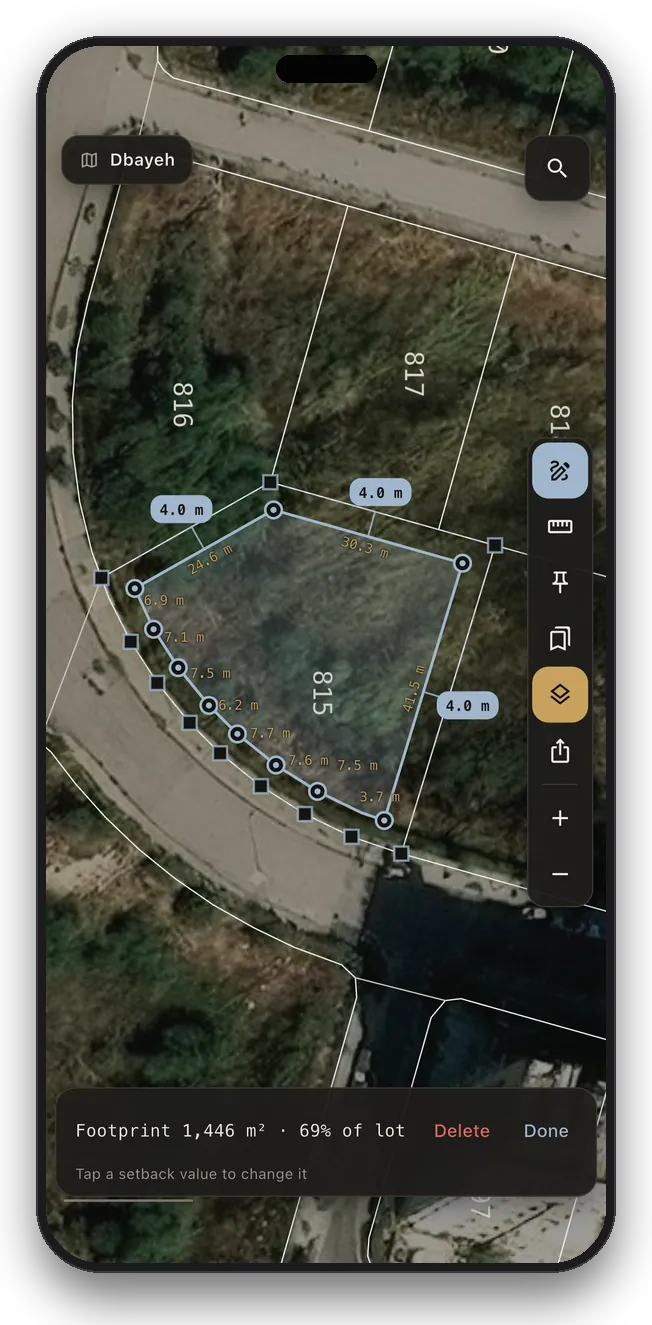
Plan a building on any lot
Sketch a footprint and the setbacks to every lot border measure themselves. Tap a value to change it and the plan slides into place, with live floor area and lot coverage.
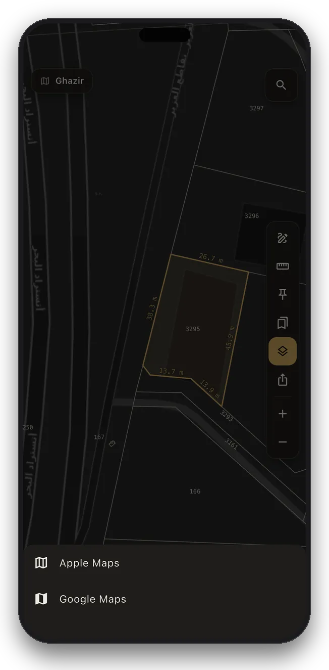
Get directions to any lot
One tap hands the parcel to your maps app and guides you to the land itself, whether it is a saved pin, a measurement, or a building plan.
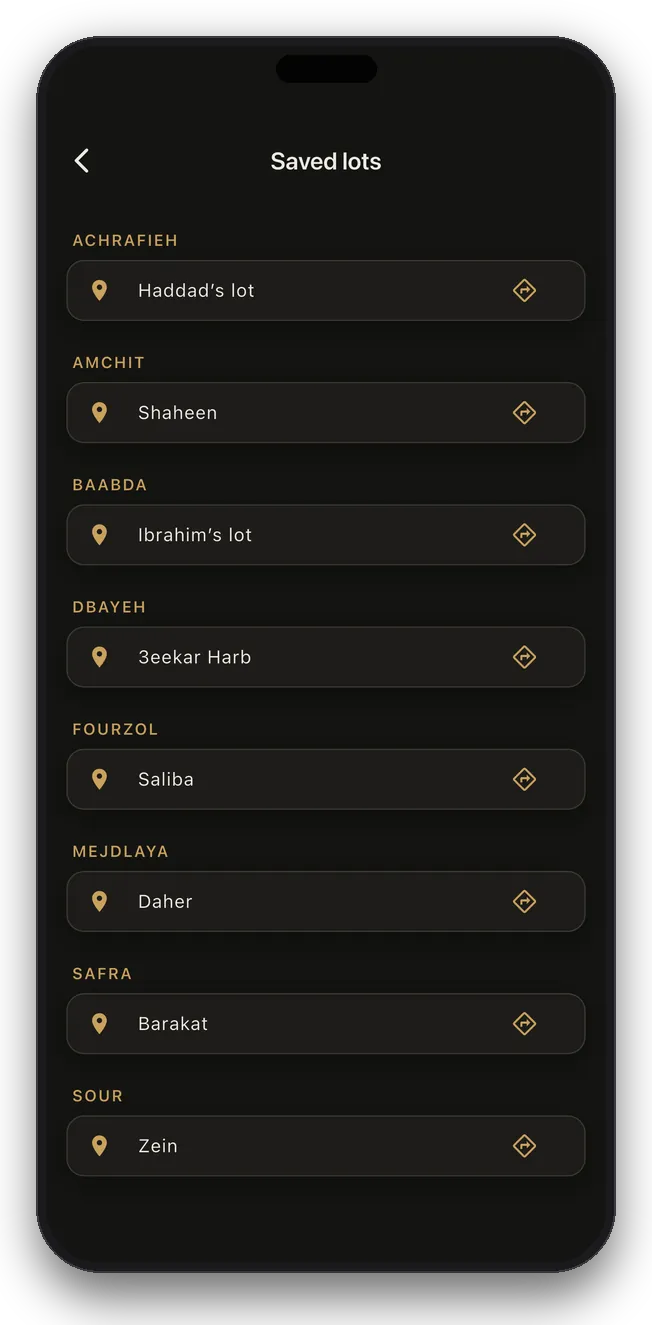
Every plot you track, one list
All your saved lots across every zone, grouped by town, each one a tap away from the map or from directions.
Built for land work in Lebanon
Find any lot in seconds
Type a parcel number and jump straight to it. The exact lot, no scrolling.
Area and perimeter
Tap a parcel and read its exact area, perimeter, and every side length.
The land in 3D
Altitude, slope and facing for any lot, with a model you can turn and tilt.
Slopes and contours
Shade every lot by how steep it is, or draw height lines across the zone.
Where you stand
Tap the location button to see the zone and the lot you are in.
Walk and measure
Walk a lot's borders with GPS guidance and get the area you walked.
A ruler that snaps
Trace any shape corner by corner for its area, slope and 3D, or draw a line for its elevation profile.
Plan a building
Sketch a footprint and every setback to the lot borders is measured for you.
Street and satellite
The parcel fabric drapes over real rooftops and roads in any zone.
Directions to any lot
One tap hands the parcel to your maps app and takes you there.
All your lots, one list
Every saved lot from every zone, grouped by town.
Pins that follow you
Name a lot and it syncs across your devices when you sign in.
The whole zone, no signal
Download once and use it in the field, in the mountains, anywhere.
Always the latest maps
Zones update themselves when maps improve. No app update needed.
JPEG and print-ready PDF
Full A4 or A3 sheets, stamped with the zone name and scale bar.
From Akkar to Naqoura
Beirut, Mount Lebanon, the North, the South, Nabatiye and the Bekaa, with new zones added regularly.
English, French, Arabic
Search zones in Arabic or Latin spelling. The app speaks all three.
On your computer too
Open app.lebcad.com and sign in with the same account.
One subscription. Every zone.
A monthly or yearly subscription unlocks every zone we cover, current and future, plus JPEG and PDF export. Over 750 zones across the whole country, with new ones added regularly.
Maps are for reference and planning. For transactions and legal matters, rely on official records and a licensed surveyor.
Frequently asked
What is LebCad?
LebCad is a phone app, also on the web, that shows Lebanon's cadastral maps: each zone drawn lot by lot with its lot numbers, over satellite imagery or a street map. You can find a lot by its number, read its area and side lengths, see it in 3D with its altitude and slope, measure land on the map or on foot, and keep whole zones offline.
How do I find a lot by its number?
Open the zone the lot belongs to (zone names can be searched in Arabic or Latin spelling), tap the magnifier and type the lot number. The map flies to the lot and shows its area, perimeter and every side length, and one tap gives you directions to it.
Which areas does LebCad cover?
Cadastral zones across the whole country: Beirut, Mount Lebanon from Jbeil to the Chouf, the North including Zgharta and Akkar, the South from Saida to Naqoura, Nabatiye, and the Bekaa from Zahle to Hermel. New zones are added regularly, and the coverage map in the app shows every zone available today.
Can I see the altitude and slope of a lot?
Yes. Tap any lot for its altitude, slope and facing, with a 3D model of the land you can turn and tilt. Terrain view shades every lot by how steep it is, or draws height lines across the zone. It all works offline in the app.
Can I measure my land by walking it?
Yes. Tap the location button to see which lot you are standing in, then walk its edges and mark each corner. The app guides you along the borders and measures the area and side lengths of the path you walked. Accuracy follows your phone's GPS, usually a few metres, so treat the result as a guide, not a survey.
Does LebCad work without internet?
Yes. Download a zone once and it works with no signal, on site or in the mountains. Downloaded zones update themselves when a map is improved.
Is LebCad free?
The app is free to download, and you can try it on the free zones. LebCad Pro, monthly or yearly, opens every zone we cover, current and future, plus JPEG and PDF export.
Are LebCad maps official?
No. LebCad maps are for reference and planning. They are not official records and not a survey. For transactions and legal matters, rely on the official land registry and a licensed surveyor.
Is LebCad available in Arabic?
Yes. The app speaks English, French and Arabic, and zone names can be searched in Arabic or Latin spelling. This page is also available in Arabic.
Can I use LebCad on a computer?
Yes. Open app.lebcad.com in your browser and sign in with the same account. Subscriptions are bought in the iPhone or Android app and work on the web too.